Unlock the Power of Drones: Revolutionize Your Topographic Surveys
- Cool Yaar Pakistani
- Oct 11, 2024
- 3 min read
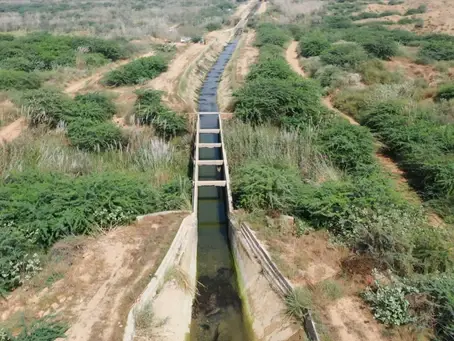
In today's rapidly evolving world of surveying and mapping, innovative technologies are revolutionizing the way we collect data for topographic surveys. One such groundbreaking technique is drone photogrammetry, which has proven to be incredibly effective, especially when surveying large-scale projects like canals. In this blog post, we will explore how drone photogrammetry has transformed the process of topographic surveying for a 24 km canal, providing accurate and comprehensive data for designers and engineers.

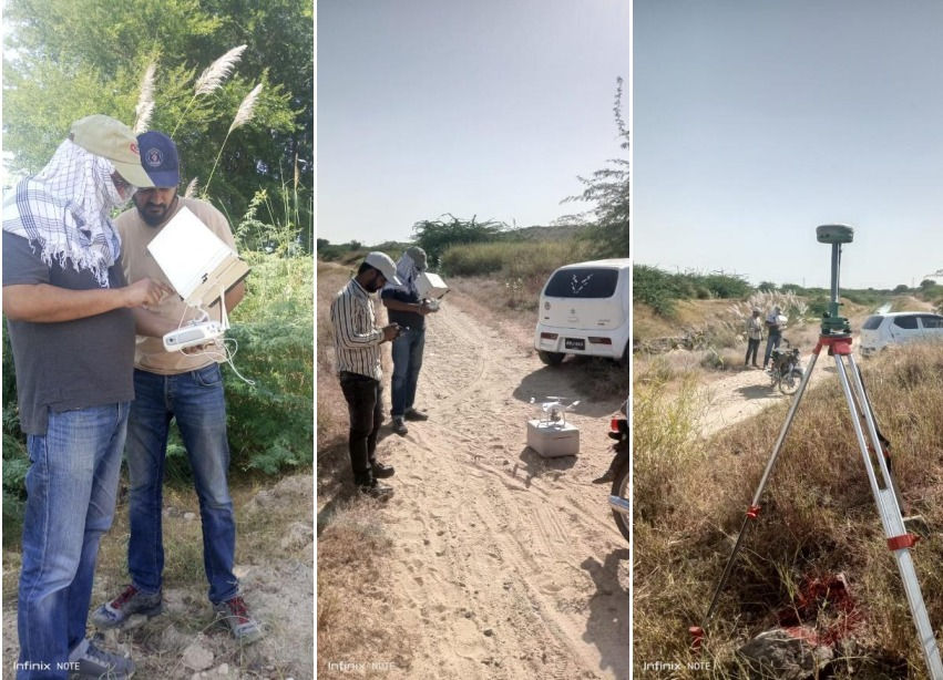
Traditionally, topographic surveys of canals involved painstaking manual measurements using RTK or total station techniques. These methods often had limitations, such as a limited number of data points and heavy reliance on the surveyor's ability to record all necessary topographic features accurately. Any missed data would affect the entire survey. However, with the advent of drone photogrammetry, these challenges are overcome.
The canal's terrain presented numerous difficulties, including inaccessible areas and inhospitable environments. Drones proved to be the perfect solution, as they could effortlessly navigate the entire length of the canal and capture high-resolution aerial imagery. Through advanced photogrammetry techniques, the drone's onboard cameras collected vast amounts of data, including detailed orthomosaic images, a digital elevation model (DEM), and other essential topographic information.

The generated orthomosaic provides a highly detailed and accurate representation of the canal and its surroundings. This stitched-together image mosaic eliminates distortions and offers a bird's-eye view of the entire survey area. The digital elevation model (DEM) further enhances the dataset by capturing the precise elevations and contours of the canal's terrain, facilitating effective design and analysis.
One of the key advantages of drone-based topographic surveys is the efficiency of data collection. Drones can cover large areas in a fraction of the time required by conventional methods. The automated flight paths ensure systematic coverage, minimizing human error and reducing the chances of missing critical data points. This efficiency translates into significant time and cost savings for the project, making drone photogrammetry an attractive option for large-scale surveys.

Looking ahead, the future of drone-based topographic surveys appears promising. As technology continues to advance, drones will become more capable, offering higher accuracy, longer flight times, and enhanced data processing capabilities. This will open up new possibilities for surveyors, allowing them to tackle even more complex projects with ease. Additionally, the integration of artificial intelligence and machine learning algorithms will enable drones to analyze and interpret data on the fly, further streamlining the surveying process.
In conclusion, drone photogrammetry has revolutionized the way we conduct topographic surveys, especially for large-scale projects like canals. The use of drones provides accurate and comprehensive data, including orthomosaic images, digital elevation models, and final CAD drawings. With its efficiency, cost-effectiveness, and adaptability to challenging terrains, drone-based topographic surveying is poised to shape the future of the industry. Embracing this technology opens up a world of possibilities for surveyors, enabling them to unlock new levels of precision and productivity.
AZ NavTeq is proud to offer a comprehensive range of drone-based topographic survey services. Our expertise extends to various land features, including large undeveloped urban land, urban environments, canals, roads, and pipeline right-of-way (ROW) surveys. With our cutting-edge technology and experienced team, we deliver accurate and detailed data that meets the specific needs of each project. To learn more about our services and explore how we can assist you, please visit our website at www.aznavteq.com or reach out to us directly at info@aznavteq.com.


Comments